Launch site elevation 1,920m; altitude difference 1,250m
Characteristics and XC Options
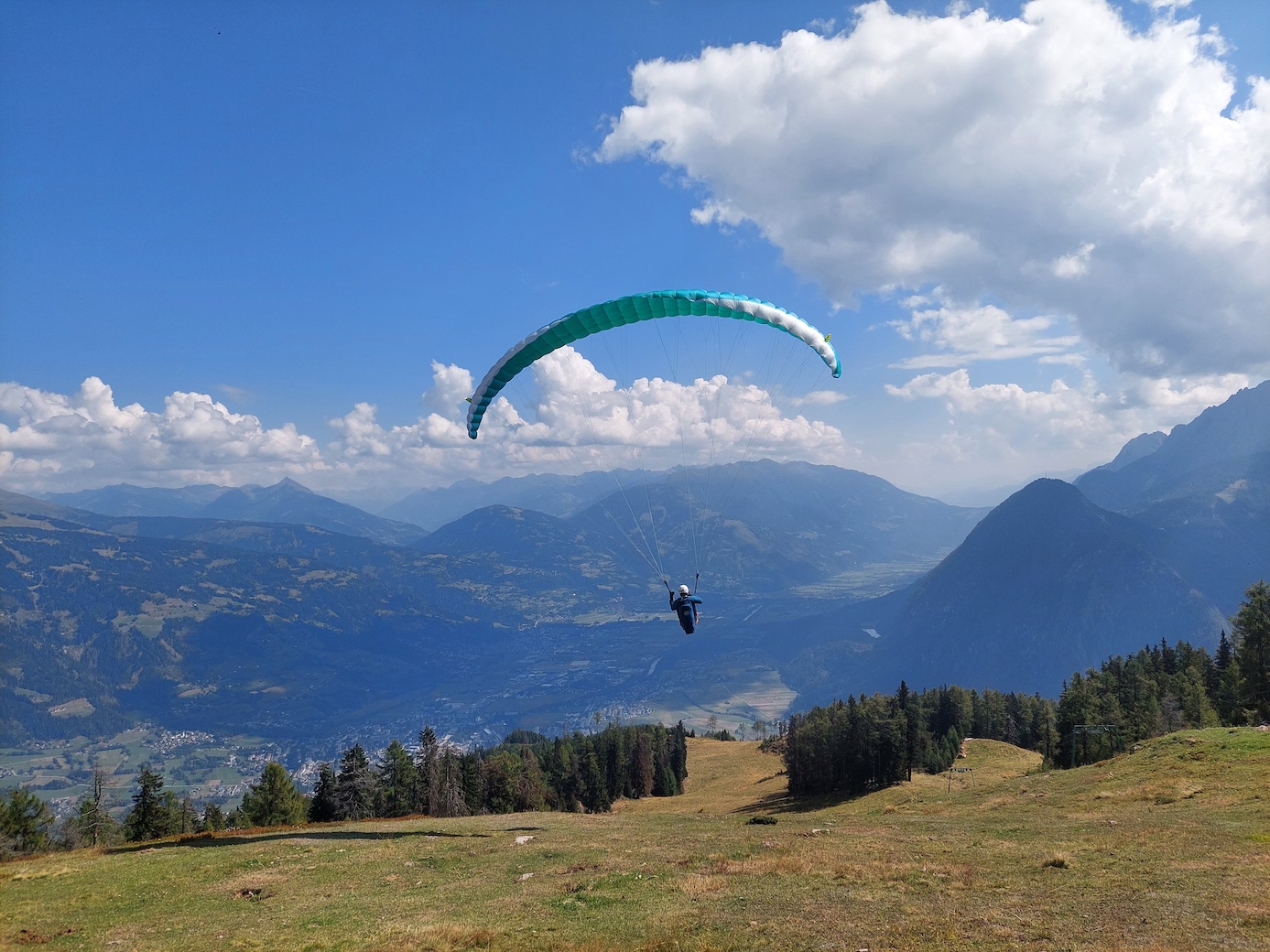
Hochstein is a very popular starting point for cross-country flights westward into the Pustertal, as thermals develop early on its southeast-facing slopes. Also glides in the early morning, for example after an overnight stay at the Hochstein Hut, or in the late afternoon are also wonderful experiences with spectacular views of the Lienz Basin. Click here for the thermal map at thermal.kk7.ch.
Accessibility
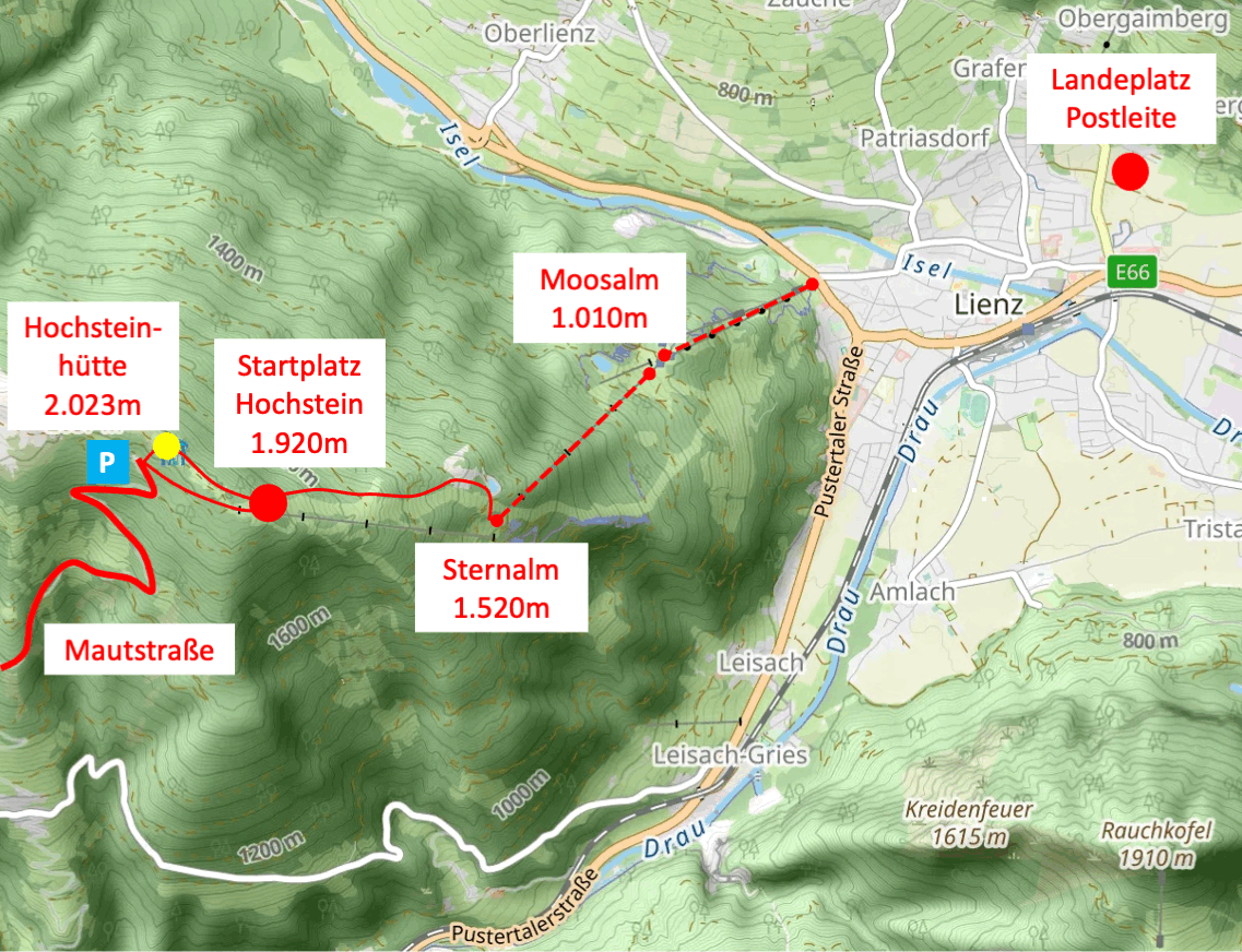
Compared to Zettersfeld with its lift connection, the Hochstein launch site is more difficult to reach.
Hike from Sternalm: When the Hochstein lifts are in operation (summer season only), you can reach the launch site from the chairlift top station at Sternalm in a hike of approximately 1½ hours via the "Märchensteig" (ca. 400 meters elevation difference)
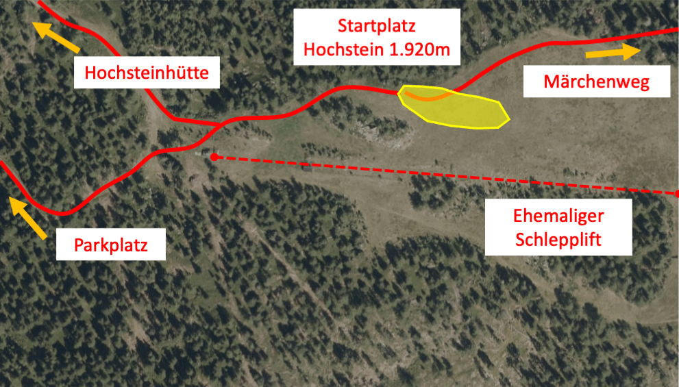
Access via the Hochstein road: This toll road leads from Bannberg to just below the Hochstein Hut. From the parking lot at the end of the road, the launch site can be reached directly via a forest track in about 15 minutes; however, the detour via the Hochstein Hut is worthwhile for its magnificent panoramic views and culinary offerings. The road is open from May to October; during the winter months, the launch site can only be reached via a longer hike from Bannberg or Lienz.
Take-off Situation
The launch site at 1,920m altitude, near the top station of a disused ski lift, is very spacious and usually allows for stress-free takeoffs to the east. The south-facing slope to the right behind the lift line often offers good thermal lift.
Landing Sites
In calm conditions or with only a light easterly wind, our Landing Site Postleite is well within the gliding angle range. Sufficient altitude should be available to cross the high-voltage power line west of the landing site. With stronger valley winds in the afternoon (see Weather Information), this can become tight, so it is advisable to look out for potential emergency landing options in meadows outside the built-up area of Lienz in good time, e.g., south of the town towards Amlach and Leisach or north of the Isel river towards Oberlienz. Should the valley wind be so strong that even these areas cannot be reached with certainty, it is advisable to land on the ski slope before entering the densely populated valley floor, e.g., in the Moosalm area.
Attention: Some older databases list two landing sites that are no longer usable. Landing directly at the bottom station of the cable car is not possible.